


Voting District CINCINNATI 19-C, Hamilton County, Ohio
About
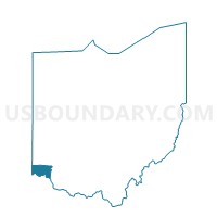
Outline

Summary
| Unique Area Identifier | 647434 |
| Name | Voting District CINCINNATI 19-C |
| County | Hamilton County |
| State | Ohio |
| Area (square miles) | 0.57 |
| Land Area (square miles) | 0.50 |
| Water Area (square miles) | 0.07 |
| % of Land Area | 87.26 |
| % of Water Area | 12.74 |
| Latitude of the Internal Point | 39.07727130 |
| Longtitude of the Internal Point | -84.61747760 |
Maps


Graphs
Select a template below for downloading or customizing gragh for Voting District CINCINNATI 19-C, Hamilton County, Ohio


Neighbors
Neighoring Voting District (by Name) Neighboring Voting District on the Map
- Voting District CINCINNATI 19-A, Hamilton County, OH
- Voting District CINCINNATI 19-E, Hamilton County, OH
- Voting District DELHI EE, Hamilton County, OH
- Voting District DELHI HH, Hamilton County, OH
- Voting District DELHI R, Hamilton County, OH
- Voting District DELHI S, Hamilton County, OH
- Voting District DELHI U, Hamilton County, OH
Top 10 Neighboring County Subdivision (by Population) Neighboring County Subdivision on the Map
- Cincinnati city, Hamilton County, OH (296,943)
- Covington CCD, Kenton County, KY (111,047)
- Florence CCD, Boone County, KY (64,720)
- Delhi township, Hamilton County, OH (29,510)
Top 10 Neighboring Place (by Population) Neighboring Place on the Map
Top 10 Neighboring Unified School District (by Population) Neighboring Unified School District on the Map
- Cincinnati City School District, OH (330,202)
- Boone County School District, KY (112,752)
- Kenton County School District, KY (98,715)
- Oak Hills Local School District, OH (64,230)
Top 10 Neighboring State Legislative District Lower Chamber (by Population) Neighboring State Legislative District Lower Chamber on the Map
- State House District 30, OH (114,509)
- State House District 31, OH (97,992)
- State House District 66, KY (52,522)
- State House District 65, KY (35,617)
Top 10 Neighboring State Legislative District Upper Chamber (by Population) Neighboring State Legislative District Upper Chamber on the Map
- State Senate District 8, OH (337,451)
- State Senate District 9, OH (298,658)
- State Senate District 11, KY (137,257)
- State Senate District 23, KY (98,810)
Top 10 Neighboring 111th Congressional District (by Population) Neighboring 111th Congressional District on the Map
Top 10 Neighboring Census Tract (by Population) Neighboring Census Tract on the Map
- Census Tract 213.04, Hamilton County, OH (5,171)
- Census Tract 214.21, Hamilton County, OH (4,342)
- Census Tract 669, Kenton County, KY (4,304)
- Census Tract 703.11, Boone County, KY (2,538)
- Census Tract 103, Hamilton County, OH (1,713)
- Census Tract 104, Hamilton County, OH (1,307)